")


July
Monday
Tekirdağ - Tekirdag - Текирдаг - Ραιδεστός
As you travel from Istanbul towards Tekirdag, it's possible to see hints of Tekirdag's identity on both sides of the road. While the left side of the road is filled with various holiday sites, the right side predominantly displays the colors of dense yellow canola, green wheat, and light yellow sunflowers according to the season. A bit further up, the densely industrial area of Corlu and Cerkezkoy districts becomes evident. This view immediately reveals that Tekirdag is a city caught between agriculture and industry.
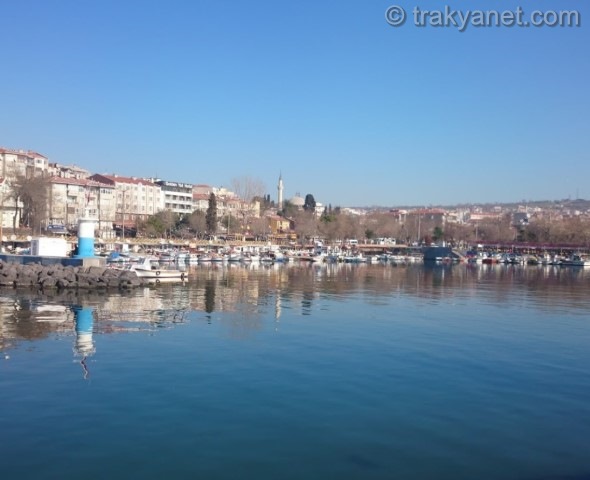
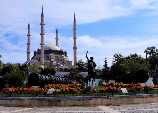
At the city entrance, as you pass the hills with a bit of greenery and many new buildings, the summer houses on the left give the impression of a resort town. Upon getting out of the car by the seaside, you can feel the scent of the sea, see restaurants promoting Tekirdag meatballs on the right, the mosque inherited from Mimar Sinan, and on the left, the newly bustling Tekirdag Port along the promenade, which otherwise appears empty except for a few simple businesses. The large shopping malls, heavy vehicle, and pedestrian traffic usually seen in rapidly developing industrial cities are yet to be felt in Tekirdag.
The effects of the concentrated industrial area in Corlu and Cerkezkoy have not yet reflected on Tekirdag's center. The center of Tekirdag carries the characteristics of the more agriculturally dense western part of Thrace, rather than the east.
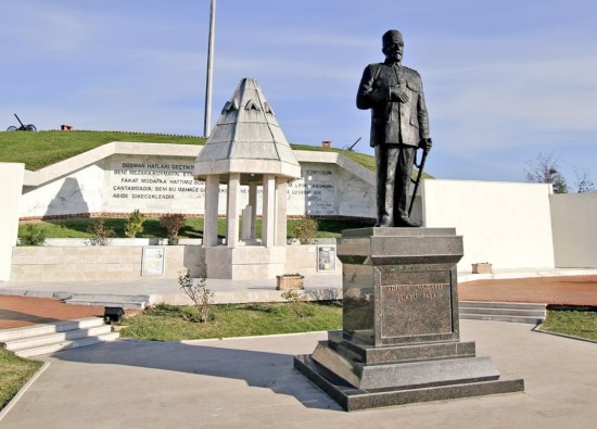
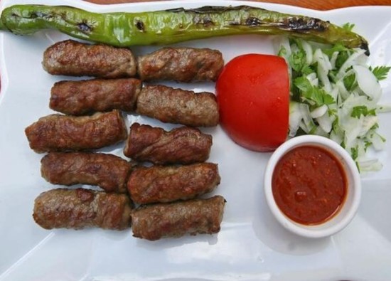
The advantageous position of Tekirdag in tourism can easily be noticed after a daily trip. The exile house of Rakoczi, the national hero of the Hungarians; the ethnography museum; many old houses that are on the verge of collapse; the governor's office where the first steps of the alphabet revolution were taken; Sarkoy, with its vineyards and wine, famous for its Blue Flag, but positioned as a holiday town; Ucmakdere with its paragliding events, beautiful view, and lack of facilities; Karacakilavuz with its handwoven products; the 19th Brigade, the first place where soldiers gathered for the magnificent resistance in Canakkale, and many other historical and cultural assets make Tekirdag uniquely beautiful. Despite these beauties, Tekirdag is a city that has only been able to market its meatballs due to shortcomings in promotion and infrastructure in tourism.
Tekirdağ is one of three provinces in northwestern Türkiye, located north of the Sea of Marmara and entirely within Thrace. It has a surface area of 6,313 km².
Tekirdağ province, bordered by both the Sea of Marmara and the Black Sea, is one of only six provinces in Türkiye with coastlines on both seas. Located north of the Sea of Marmara and entirely within Thrace, Tekirdağ is bordered to the east by the districts of Silivri and Çatalca, and to the north by the districts of Vize, Lüleburgaz, Babaeski, and Pehlivanköy, all of Kırklareli province. It has a 1.5 km coastline on the Black Sea to the northeast. Located on the Thrace-Kocaeli Peneplain, Tekirdağ province's landforms include 75.2% plateaus, 15.5% plains, and 9.3% mountains. Generally, there are no high mountains, steep slopes, or valleys. Coastal plains along the Sea of Marmara are covered with alluviums carried by rivers. The plateaus are characterized by erosion surfaces. Istranca lies in the north, and Tekir Mountain, Koru Mountain, and the Ganos Mountains lie in the south.
Tekirdağ falls into the subhumid climate type, according to the hydrographic regions identified by general humidity indices. Its precipitation regime falls within the Mediterranean precipitation regime. The Tekirdağ coastline, influenced by the Mediterranean climate, experiences hot summers and mild winters. The coastal strip encompassing the Ergene basin has a more continental climate. Precipitation is generally rain, with little snow. The moderate climate facilitates agriculture. The lowest average precipitation in Tekirdağ occurs in August and the highest in December. The coastal strip between Şarköy and Kumbağ exhibits Mediterranean climate characteristics. This characteristic stems from the mountains running parallel to the coast in the north and the warming effect of the sea.
The inland areas are under the influence of a continental climate. The winters are particularly influenced by the northern European climate. Therefore, it lacks a distinct climate type. Summers are generally hot and dry, like those in the Mediterranean. Because the Siberian anticyclone reaches these areas from the Balkans, winters are dry and freezing. The inland areas lack the moderating effect of the Marmara Sea. In July, the temperature along the coast in Tekirdağ province center is 25 degrees Celsius, while in Çorlu and the surrounding areas, it is around 26-30 degrees Celsius.
Tekirdağ is very windy in both summer and winter. The dominant and constant wind is the northeasterly wind, while the second most important wind is the southerly wind. As long as there is high pressure in Central Europe, the northerly wind blows strongly in Thrace and Tekirdağ. When the pressure decreases, the northerly wind blows only during the day and becomes a breeze.
Because the southerly wind enters Thrace from the Meriç Valley, it blows heavily in inland districts like Çorlu. It is frequent but short-lived in Tekirdağ and its coastline. Breezes in March, April, and May bring rain.
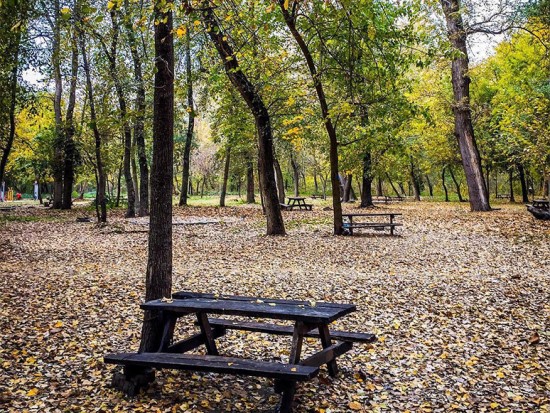
Tekirdağ is quite poor in vegetation. Its most distinctive feature is the maquis and shrubland that develops in accordance with the climate type on the slopes overlooking the Sea of Marmara. In the inland areas, partly under the influence of the continental climate, oak species that shed their leaves in winter, hornbeam, ash, silver linden, plane tree, and elm trees are found. Willow is the characteristic tree along the rivers.
In Tekirdağ province, 25% of the gross agricultural production value comes from livestock. While there is a decrease in the number of pasture-based livestock, there is an increase in the number of cattle.
The fact that all kinds of relations between Anatolia, the Near East, and Europe, such as migration, invasion, trade, culture, and exchange, took place through Thrace has been a significant characteristic of the region, both in the past and today.
In Tekirdağ, settlements dating to the upper levels of the Old Stone Age have been found in caves in the Güneş Kaya and Güngörmez valleys in the Saray district (40,000-10,000 BC). Stone axe production centers dating to the earliest land settlement period (Neolithic) have been found in the Şarköy district (8,000-5,000 BC). The Tekirdağ Museum Directorate has identified Chalcolithic Age settlements (Top Tepe 4,300 BC) in some river mouths along the Marmara Sea, as well as contemporary settlements from the 1st and 2nd levels of Troy along the coast. (Early Bronze Age I-II 3,000-2,400 BC) There were communities in Thrace, defined as Proto-Thracians, with much lower levels of social organization, who came to Thrace with a wave of migration between 1400 and 1,000 BC.
While the Thracians lived as nomadic communities, colonists from Samos, arriving from the Aegean islands in the 8th-6th centuries BC, established colonial cities along the shores of the Sea of Marmara. The most important of these are Perinthos (Marmara Ereğlisi) and Bisanthe (Barbaros), located within the borders of present-day Tekirdağ. Between 546 and 430 BC, the Thracian region was invaded by Persians from the east and remained under Persian rule.
In 352 BC, King Philip II of Macedonia, during his campaign against Thrace, conquered the region from Ipsala to the vicinity of Marmara Ereğlisi. (Early Bronze Age I-II 3000-2400 BC) Between 1400 and 1000 BC, a wave of migration came to Thrace, and in Thrace, there were communities with a much more backward level of social organization, known as Proto-Thracians.
While the Thracians lived as nomadic communities, colonists from Samos, arriving from the Aegean islands, established colonial cities along the shores of the Sea of Marmara in the 8th-6th centuries BC. The most important of these are Perinthos (Marmara Ereğlisi) and Bisanthe (Barbaros), located within the borders of present-day Tekirdağ. Between 546 and 430 BC, the Thracian region was invaded by Persians from the east and remained under Persian rule.
In 352 BC, King Abdülhamid II of Macedonia conquered the region. During his campaign against Thrace, Philip occupied the coastal areas from Ipsala to the Marmaraereğlisi region. Perinthos (Marmaraereğlisi) offered fierce resistance. Alexander the Great, who succeeded Philip II and campaigned as far as India, captured Perinthos (Marmaraereğlisi). After his death, the region came under Lysmokhus' rule. The region changed hands repeatedly between the Macedonian and Odrysian kings until it came under Roman rule in 30 BC.
Tekirdağ entered history in the late Roman period in the 3rd century AD under the name Rhaedestus and was known as Rodosto during the Byzantine period. After the Ottomans captured Tekirdağ from the Byzantine Tekfurs in the 14th century, the name Rodosto evolved into Rodosçuk. Rodosçuk, which was called by this name until the 18th century, later began to be called "Tekfurdağı", which was claimed to be given to the Byzantine feudal lords, and after the Republic, it was renamed Tekirdağ as a province in 1927.
Tekirdag
|
Tekirdag Governorship
|
Tekirdag Metropolitan Municipality
|
| Area | 6.190 km² |
| Altitude | 30 m |
| Population 2025 | 1.208.441 |
| Telephone Area Code | 282 |
| License Plate Code | 59 |
| Postal Code | 59XXX |
| Governor of Tekirdag | Recep Soyturk |
| Tekirdag Metropolitan Municipality Mayor | Candan Yuceer |
| Update | |
| View | 7.378 |
| District Populations Tekirdag (2025) | ||
|---|---|---|
| Order | Districts | Population |
| 1 | Corlu | 306.939 |
| 2 | Suleymanpasa | 226.582 |
| 3 | Cerkezkoy | 223.975 |
| 4 | Kapakli | 152.509 |
| 5 | Ergene | 68.648 |
| 6 | Saray | 51.468 |
| 7 | Malkara | 50.123 |
| 8 | Sarkoy | 34.458 |
| 9 | Marmaraereglisi | 33.623 |
| 10 | Muratli | 30.410 |
| 11 | Hayrabolu | 29.706 |
| Total Population (2025) | 1.208.441 | |

Cerkezkoy

Kapakli

Muratli

Tekirdag Statistics
Detailed statistical data of the Tekirdag region are available on our pages.

District Populations Tekirdag
Province, district, town, neighborhood, and village population information

Tekirdag Migration Information
Immigration information received and given by Thracian settlements

Tekirdag Economic Information
Detailed statistics on the livelihoods of the Thracian people

Tekirdag Tourism Information
Tourism data of the Tekirdag region

Tekirdag Health Information
Health personnel statistics with birth and death information in Tekirdag

Tekirdag Election Results
Results of the Turkish parliamentary general elections

Other Tekirdag Statistics
Other statistics related to the Tekirdag region

Tekirdag Topics
All kinds of detailed information about Thracian settlements

History
History of Tekirdag

Geography
Geography of Tekirdag

Education
Tekirdag educational institutions

Administrative Status
Tekirdag administrative administrations

Economy
Tekirdag economy

Health
Tekirdag health institutions

Transport
Tekirdag transportation information

Press
Tekirdag press organizations

Sport
Tekirdag sports infrastructure and clubs

Celebrities
Celebrities born in Tekirdag
Tekirdag Tourism Information

The New Bandirma-Tekirdag Train Ferry Line Has Been Opened
Transport and Infrastructure Minister Abdulkadir Uraloglu announced that the Bandirma-Tekirdag Train Ferry Line, now operational, will provide an annual freight carrying capacity of 2.8 million tons. It was stated that the line will strengthen its position in international transportation.

Truffles Are Being Exported from Tekirdag
 Neighborhood")
Transformation Begins in Kore (Hidiraga) Neighborhood

Adrenaline junkies meet the sky in Uçmakdere

Purple frame season in Tekirdag

To the High, High Hills
Don't let them build houses on high, high hills
Don't let them give their daughters to distant lands
Let them not look down upon the only one, the mother
Let it be known to the flying birds as well
I miss my mother
Both my mother and my father
I miss my village
If my mother had a sail, she would open it and come
If my father had a horse, he would ride it and come
If my siblings knew the roads, they would come
Let it be known to the flying birds as well
I miss my mother
Both my mother and my father
I miss my village
I Wear Light, Light

Hilton Garden Inn Corlu
The hotel is located at the D100 Highway exit, five kilometers from the Corlu Industrial Zone and the city center. Orion and Trend Arena Shopping Malls are a five-minute drive away, and DHMI Tekirdag Corlu Airport is 10 km away. Enjoy freshly prepared meals in the restaurant. Room service is available between 5 and 11, and the 24-hour Pavilion Pantry offers drinks and snacks. WiFi is free.

Hattusa Vacation Thermal Club Saray

Ramada by Wyndham Tekirdag
Updating
Data entry on our pages is ongoing and will be published as soon as possible.
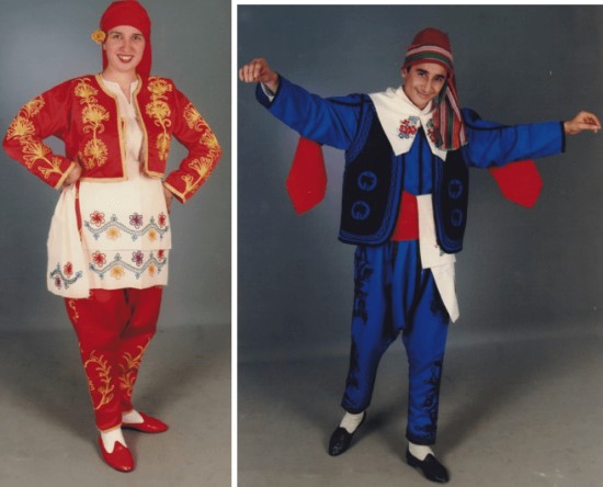
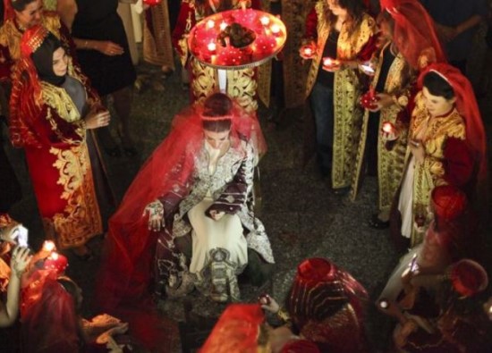
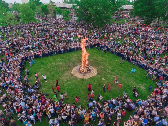
Tekirdag Photos


