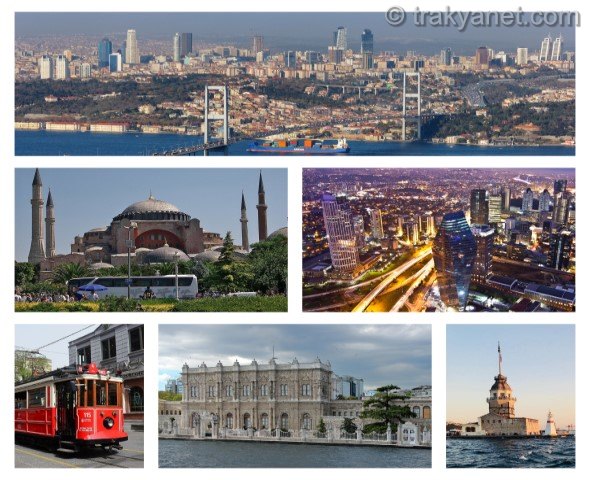
")


Tekirdag is one of three provinces in northwestern Turkiye, located entirely within Thrace and north of the Marmara Sea. It is also one of six provinces in Turkiye with coastlines on two seas. Tekirdag lies between 41º 34' 52" - 40º 52' 53" - 41º 35' 28" – 40º 32' 23" north latitudes and 28º 09' 14" - 26º 42' 42" – 28º 08' 34" – 26º 54' 24" east longitudes. The province covers an area of 6,313 km² and its elevation above sea level ranges from 0 to 200 meters. It is surrounded by Silivri and Catalca districts of Istanbul to the east, Vize, Luleburgaz, Babaeski and Pehlivankoy districts of Kirklareli to the north, and the Marmara Sea and Gelibolu district of Canakkale to the south.
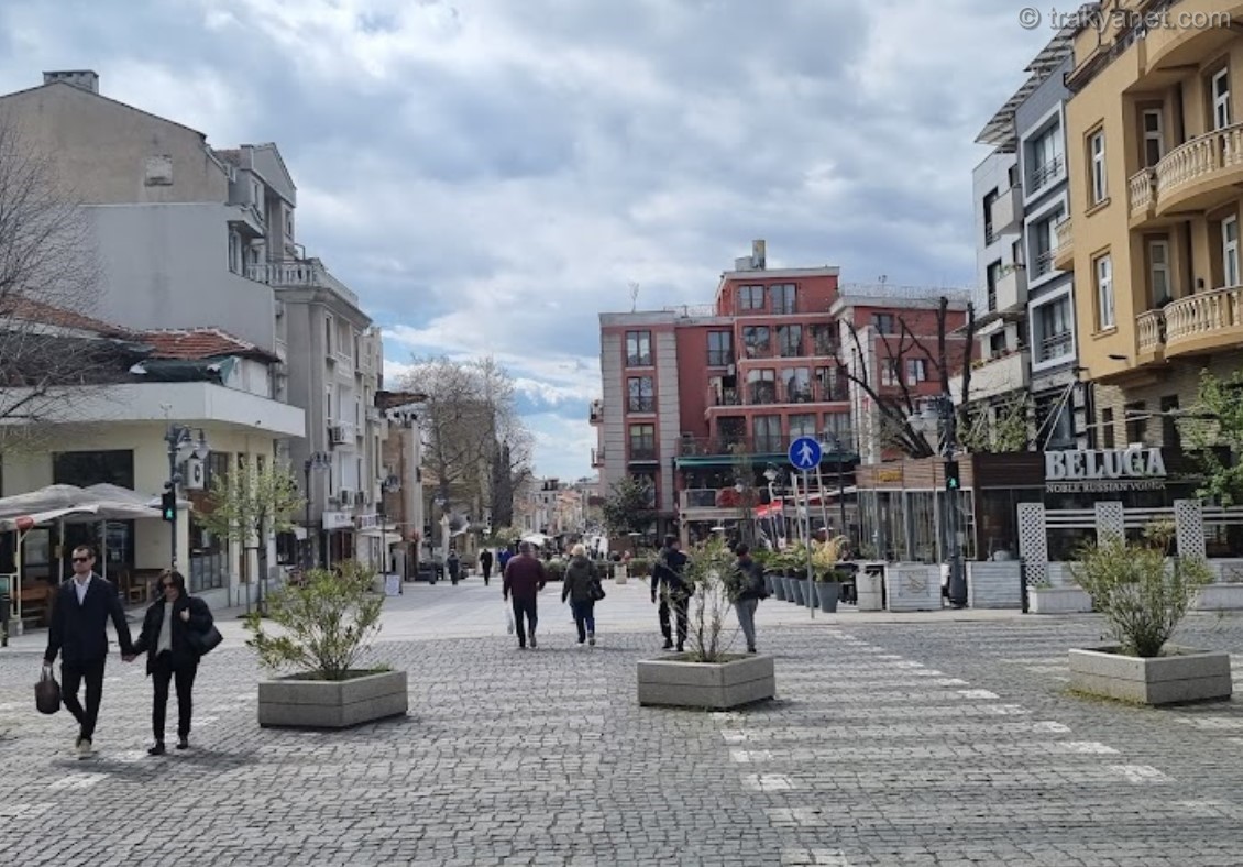
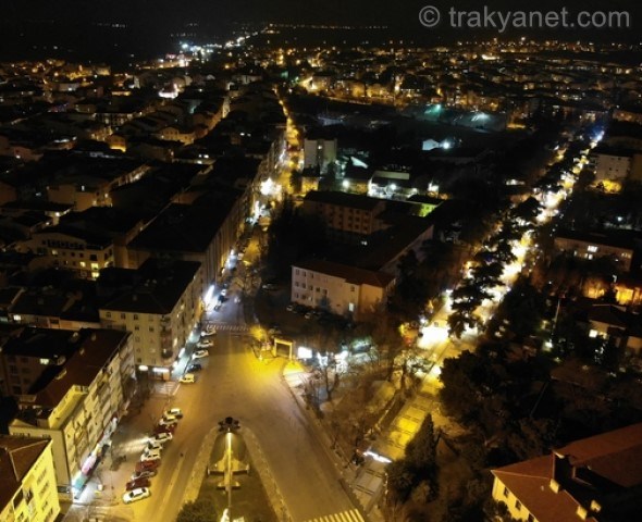
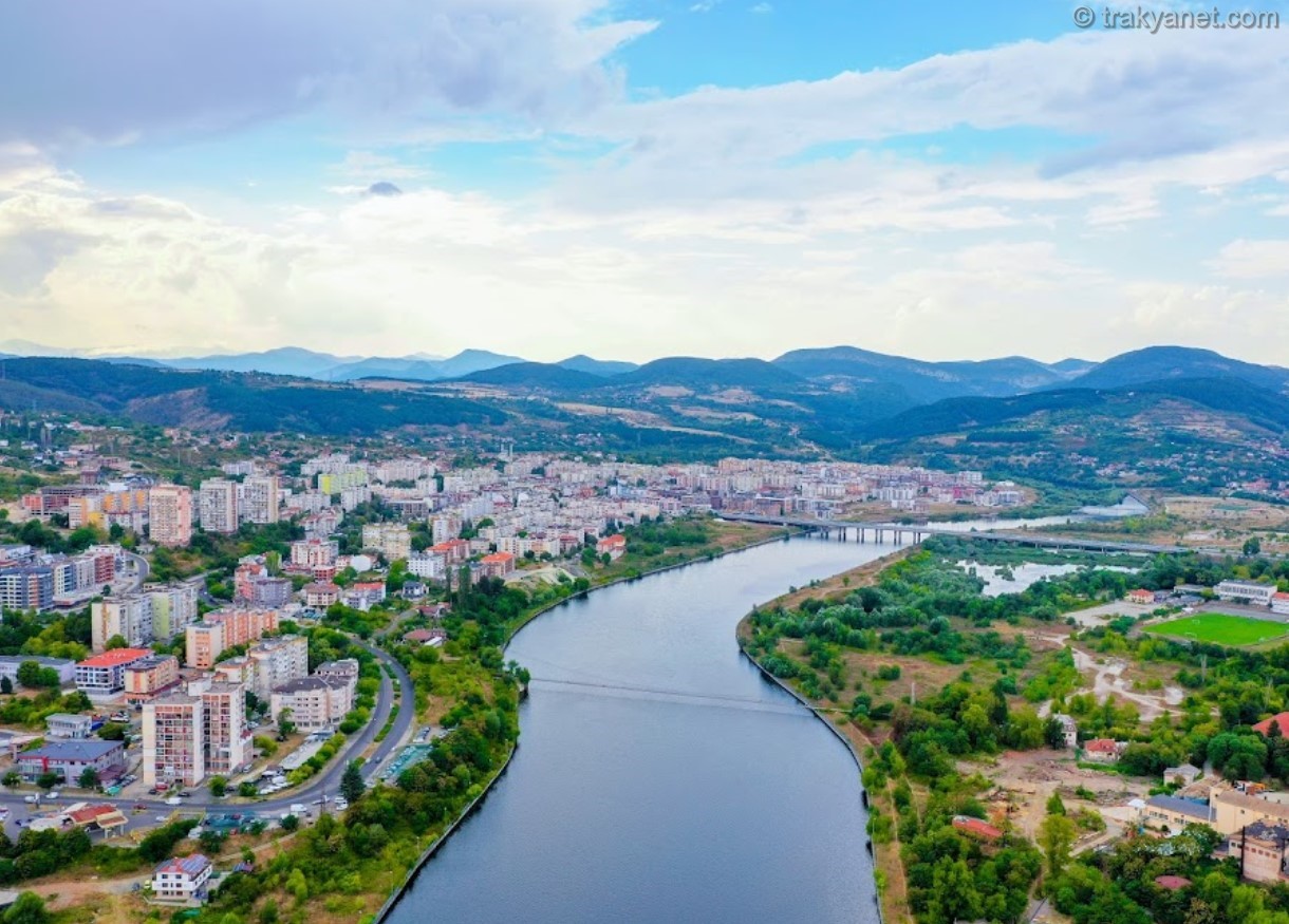
It has a 1.5 km coastline on the Black Sea to the northeast. Tekirdag, the largest city in the southern part of the Ergene Basin, is situated on the shore of a wide bay where roads from the southern Ergene region and the north meet the Marmara Sea. The city center is spread out on three successive steps, partly on the valley slopes and partly on the coastal cliffs. The elevation is 12 m at the first step where the governor's mansion is located, 25 m at the step where the market is located, and 45 m at the step to the north where the Brickmakers' High School is located.
Geological Structure
Tekirdag's geological structure is quite young. During the I. Geological Period, the province was covered by seas. During this time, terrestrial sediments formed at the bottom of the seas due to erosion. In the II. Geological Period, the Tekir Mountains, along with the North Anatolian Mountains, were formed under the influence of the Alpine folding. The previously formed older basement and sedimentary layers were also fractured and folded in places. At the end of the III. Geological Period, in the Neogene, Tekir Mountain subsided and flattened again. During this period, sandstone and marl deposits accumulated on the plateau extending north of Ganos and Koru Mountains. The province acquired its present-day appearance in the IV. Geological Period. While Anatolia and Thrace rose, the Aegean, Marmara, and Black Sea basins subsided. The soils generally consist of clay-containing and cemented sandstones. Brief information about the formations observed in Tekirdag and its immediate surroundings is given below, from oldest to youngest. The term "formation" describes groups of rocks that can be distinguished from each other due to their different geological characteristics and appearances in the terrain.
- YENIKOY MIXTURE: It consists of serpentinite, bluesite, diorite, porphyritic alteredasite, phyllite, graphite, schist, chlorite, schist, metadolerite, spilite, metachert, and recrystallized limestone blocks.
- LORD FORMATION: Characterized by reddish-green to greenish-ash colored, thin to medium-layered limestone. The upper sections are partly in the form of limestone with quartz sand.
- KARAAGAC HARBOR FORMATION: It consists of alternating layers of siltstone, claystone, and sandstone with lateral and vertical transitions between them, and lenses of gravelstone located between them.
- KOYUN LIMANI FORMATION: Begins with massive mudstone that is grey, light grey at the base, and black towards the top; it transitions to sandstone and mudstone towards the top.
- FICITEPE FORMATION: Generally consists of conglomerate-sandstone with decreasing grain size towards the top, interspersed with mudstone and very fine-grained sandstone.
- SOGUCAK LIMESTONE FORMATION: It consists of white to grayish-white, locally yellowish-white, sandy and clayey-layered limestone and carbonates with dissolution cavities.
- GAZIKOY FORMATION: It consists of very fine-grained sandstone and tuff-infused rocks in places.
- KORUDAG FORMATION: It consists of alternating sandstone and claystone, with conglomerates located between them.
- KESAN FORMATION: It consists of alternating sandstone and claystone, with lens-shaped conglomerates and volcanic rocks interspersed between them.
- YENIMUHACIR FORMATION: It consists of sedimentary rocks dominated by claystone and mudstone, with occasional inclusions of sandstone.
- DANISHMENT FORMATION: It consists of claystone, siltstone, and marl rocks.
- ERGENE FORMATION: Consists of white, yellowish-white, loosely cemented gravel-sand, colored clay, pebbles, and clayey mudstone.
- THRACIAN FORMATION: Consists of conglomerate, sandstone, and siltstone.
- ALLUVIUM: It consists of sedimentary rocks such as clay, silt, sand, and gravel.
Landforms
The Thrace region, located in the southeastern part of the Balkan Peninsula, has diverse morphological units. These primarily include mountains and hills of varying elevations, lower plateaus, and plains of varying sizes. In the Tekirdag region, the mountainous units are the Istranca (Yildiz) mountain range in the north and the Ganos (Isik) and Koru mountains in the south. Between these two mountainous areas, there are gently, moderately, and sometimes steeply sloping peneplains, dissected by the tributaries of the Ergene River, as well as high hills and sloping hillsides in the southern and, in places, central areas.
Mountains
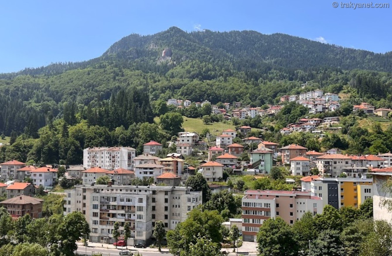
The Tekir Mountains, forming the most important elevation in the province, start 12 km south of Tekirdag city at Kumbag and extend in a range (60 km) to the Gelibolu Isthmus. Its highest point is Ganos (Isik) Mountain. Although relatively low (945 m), it gives the appearance of a majestic mountain due to its location right next to the Marmara Sea. The profile of Ganos Mountain is desymmetrical. The southern slope is steeper than the northern slope. The area between Kumbag and Gazikoy, in particular, descends very steeply to the coast. This mountainous massif is deeply cut by short streams such as Isiklar Stream, Semetli Stream, Caydere and Dolapdere from the north; and Dutlimani Stream, Koydere, Ucmakdere, Yatandere, Degirmendere, Haskoy Stream and Buyukdere from the south.
Therefore, although the slopes of the Ganos Mountains are fragmented, their tops are not steep. When viewed from above, they give the appearance of a plateau. This mountainous area is distinguished by the lushness and diversity of vegetation in the lower parts surrounding it. Due to the effect of altitude on precipitation, the Ganos massif is partly covered with forests and shrubs. Hornbeam, oak, and linden trees seen on the northern slopes give way to dry forest and maquis communities on the southern slopes. Korudag, located to the west of the Ganos Mountains, is one of the most important elevations in southern Thrace. Extending in a northeast-southwest direction, the elevation of this massif reaches 725 meters at the Kizilpinar peak. The Koru Mountains are composed of mumilitic gray and marl in the flysch facies, with brown and greenish colors, and are dissected in places by basalt flows. The face of the massif facing the Gulf of Saros is steeper than the northern side. Korudag has the appearance of the Ganos Mountains, which are dissected by streams.
The low plateaus in the north are poor in vegetation. Oak and shrub forests are found here and there. However, significant red pine forests are located in the higher parts of Korudagi. The eastern part of the province is less elevated. Some ridges are seen on gently undulating plains. One of these, around Corlu, extends in an east-west direction. This ridge, which delimits the Ergene basin and acts as a watershed line, meets the foothills of Istranca in the east and Tekirdag in the west. The Istranca Mountains (Yildiz Mountains) begin in Cerkezkoy and rise towards the north. Egrektepe (234 m), Yassitepe (352 m), and Karatepe (484 m) are notable peaks. The eastern slopes of these peaks descend to the Black Sea. From Bahcek, between Karatepe and Yesilkulak peaks, the provincial border gradually decreases, and there is a beautiful sandy coastline on the Black Sea. In this place called (Kunduzluk-Kastro) Camlikoy, the Istanbul provincial border begins to the east of the stream that reaches the sea, and the Kirklareli provincial border begins to the west.
Plains
Inland, there are wide and fertile plains covering the broad-based valleys of rivers. The most important of these are the Ergene Plain, which extends westward from Cerkezkoy along the Ergene riverbed, and the Hayrabolu and Cene Plains, which stretch along the alluvial beds of the Hayrabolu and Cene (Besiktepe) streams that flow into the Ergene River. The narrow and small coastal plains along the Marmara coast were formed by the accumulation of materials brought by rivers along the coast. The plains formed in the beds of the streams that reach the sea are delimited as follows, starting from the east of the province (the Istanbul border): Kinik Plain between Sultankoy and Marmara Ereglisi, Kumluca Plain between Marmara Ereglisi and Yeniciftlik, Serefli (Basalan) Plain between Yeniciftlik and Karaevli, Degirmenalti Plain between Karaevli and Koseilyas, Naip Plains between Barbaros and Kumbag, and the Sarkoy coastal plain extending from Haskoy to Kizilcaterzi on the southern slopes of the Tekir Mountains.
Behind these plains, terraces of varying elevations were formed as a result of coastal erosion. These terraces are more prominent along the coasts of Marmara Ereglisi, Tekirdag, Murefte, and Sarkoy.
Valleys
- Hayrabolu Valley: Formed by the Hayrabolu Stream, the Hayrabolu Valley is a "V" shaped valley with two slopes of different gradients. The southern slope of the valley is steeper than the northern slope. The valley floor is sandy and gravelly. This structure extends in a thin strip to the Sipahi Stream, from where it widens to the east. In this widening section, small plains such as Ibrice and Cevizdere have formed.
- Kurtdere Valley: A V-shaped valley carved by the Kurtdere stream, a tributary of the Hayrabolu Stream, near the village of the same name. The depth of the valley increases towards the north, starting from Besyalak Spring. The stream flows through the alluvium in the valley, meandering. South of Kutlugun, on the western slopes of the valley, there is a slope 15-20 meters high and 6-7 meters deep. The slopes of the valley carved by a second stream joining Kurtdere right next to Baglarsirti Hill are steeper. The vegetation in these areas is quite dense.
- Cengelkopru Valley: This valley was formed by a small stream called Cengelkopru. The western slopes of this valley are less eroded due to the resistance of the sandstones. The valley floor is covered with coarse-grained sandy, gravelly alluvium.
- Curcura Valley: Formed by the Curcura Stream, a tributary of the Hayrabolu Stream, this valley has a "V" shape, with its two slopes having different inclines. Thin strips of clay, sand, and gravel are found in the valley, through which the stream flows. Sandstone blocks are found along the valley slopes. The eastern slope of the valley has become flatter due to significant erosion.
- Corlu Valley: This valley, carved by the Corlu Stream, extends in a northeast-southwest direction north of the Corlu district. During the uplift movements of the Quaternary period, the valley was rejuvenated and buried. Gravel is found in places throughout the valley. The southern slopes of the valley are steeper than the northern slopes. Mass movements are observed along these steep slopes, and alluvial cones are encountered in places.
- Golcuk Valley: The valley, carved by the Golcuk Stream, has two slopes with different gradients. The northern slopes of the valley descend gently to the plain, while the southern slopes are steep. The steep slopes are composed of Paleozoic schists.
Coastal Landforms
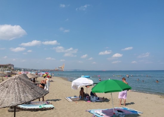
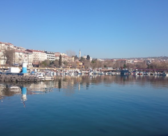
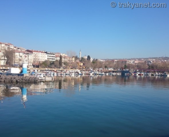
Tekirdag has a 133 km coastline on the Marmara Sea, stretching along its southern border. It also has a 2.5 km coastline on the Black Sea. Except for narrow and small coastal plains, the Marmara coast is generally high. The only natural harbor on the Tekirdag coast is Marmara Ereglisi. Marmara Ereglisi is situated on a peninsula. Its eastern side, the Marmara Ereglisi harbor, forms a semicircle with a diameter of 1600 meters. Its mouth is open to the northerly winds, but sheltered from other winds. It serves as a harbor where boats seek refuge from strong southerly and westerly winds.
The coastal section of Tekirdag province between Marmara Ereglisi and Kumbag generally has a low-lying and sandy appearance. The beaches along these coasts are mostly formed from the accumulation of sand dunes, which are the result of the erosion and dissolution of sandstone.
The Barbaros coast is a fine example of a cliffy coastline eroded by sea and rivers. These cliffs are located 200-300 meters south of the mouth of the Barbaros stream. Their elevation above sea level is approximately 10-12 meters. The cliffs, formed from sedimentary layers, have distinct strata. Fairy chimneys have formed in the more durable sections between these strata. Marine animal fossils found in the strata indicate that the plain was once a marine terrace.
The area between Kumbag and Gazikoy has a high coastline due to the Ganos Mountains descending steeply to the sea. The coastal sections consist of coarse pebbles. Between Gazikoy and Sarkoy, the coastline drops again, giving way to beaches covered with sand dunes.
The coastline of Tekirdag province, stretching from Kastro (Camlikoy) Bay to Cilingoz Bay on the Black Sea, has a high and steep cliffy appearance. Alongside wide-mouthed bays like Kastro Bay, which are shaped like pockets, there are also narrow and small, notch-shaped bays. This low coastal plain (Kunduzluk-Kastro) in Camlikoy, rarely found on the steeply descending coasts of the Istranca Mountains, is filled with alluvium brought by the Bahcekoy stream and sand dunes brought by the waves.
Earthquake Situations and Tectonics
Tekirdag is located near the North Anatolian Fault (NAF) zone, which is approximately 1,200 km long and 100-15,000 m wide, consisting of numerous faults (15-25 km), starting from Karliova and passing through Erzincan, Niksar, Ladik, Gerede, Bolu, Sakarya, and the Marmara Sea to the Gulf of Saroz. Within the borders of Tekirdag province, the faults that could cause earthquakes are the Saroz-Gazikoy fault and fault segments located along the edges of depressions in the Marmara Sea. The Saroz-Gazikoy Fault is approximately 50 km long and passes through the settlements of Kavak, Yenikoy, Golcuk, Yayakoy, Guzelkoy, and Gazikoy. This fault, which has caused many earthquakes in the past, most recently caused a magnitude 7.3 earthquake on August 9, 1902. The fault segments located along the edges of the depressions in the Sea of Marmara, which form part of the North Anatolian Fault (NAF) zone, operate independently but together with the system.
According to many researchers today, earthquakes with a magnitude greater than 6.6 are expected to occur every 250-350 years in the segments forming the North Anatolian Fault (NAF) zone, earthquakes with a magnitude between 5.4 and 6.6 every 150-200 years, and smaller magnitude earthquakes every 50-60 years. According to the Turkish Earthquake Zones Map dated April 18, 1996, published by the Ministry of Public Works and Housing, Sarkoy, Murefte, and Barbaros are located in a first-degree earthquake zone; therefore, particular attention should be paid to the regulations regarding earthquake safety in construction projects in these settlements.